
As drone technology advances, they are being utilised in various industries for different purposes. One of the most exciting developments in this field is using drones for 3D mapping. With their incredible versatility and ease of use, drones are revolutionising how we can create accurate 3D topographical maps much faster, more efficiently, and safer than traditional surveying methods. In this blog, we’ll explore the benefits of using drones for 3D mapping and how they can help you take your surveying tasks to new heights. This technology has opened up new possibilities for surveying construction sites, analysing land use changes, monitoring the environment, and carrying out various other mapping tasks. So read on to learn more about the possibilities of drone-based 3D mapping!
What Is Drone 3D Mapping?
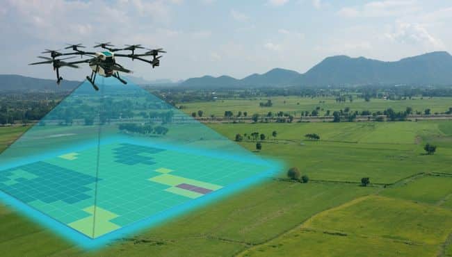
Drone 3D mapping is the process of using drones to capture aerial images and create 3D maps. This process is known as photogrammetry. This technology has revolutionised how data is captured in many industries, such as construction, and agriculture, making it possible to gather accurate data from almost any location in a fraction of the time required for traditional ground-based methods.
3D maps are generated through a technique called photogrammetry. Drones come equipped with high-quality cameras that take many photos from different perspectives. Images should have at least 70% overlap for better details and accuracy for photogrammetry. These images are then processed using mapping software such as Pix4D or DroneDeploy and combined to form a 3D model of the surveyed area. This data is analysed to measure elevation, calculate distances, identify potential risks or hazards, and land use changes.
In addition to high-resolution cameras, many drones can also be equipped with LiDAR sensors and infrared and multispectral cameras that will capture different data types for detailed 3D map analysis.
The Benefits Of Using Drones For 3D mapping
One of the key benefits of using drones for 3D mapping is that they offer a much more cost-efficient solution than traditional surveying techniques. By eliminating the need for costly human labour and equipment, drone surveys can be completed quickly and easily at a fraction of the cost. This technology opens up new possibilities for surveying construction sites, analysing land use changes, and monitoring the environment with unprecedented speed without compromising safety and accuracy.
Another significant benefit of drones is their ability to access hard-to-reach areas inaccessible by humans or traditional surveying methods. This feature makes them ideal for gathering data in tight spaces such as industrial sites, quarries, and mountainous terrain.
This is particularly helpful in cases where uneven terrain makes ground-based surveying difficult and dangerous for surveyors.
Additionally, many commercial drones are not affected by the same weather restrictions that often keep other aerial surveying methods grounded, meaning they can collect data even in less-than-ideal conditions.
As drones are mobile and easy to operate, they can be used to capture 3D mapping data regularly. This feature will be handy for industries needing to collect periodically aerial data, like construction sites, agriculture, and environmental monitoring.
Finally, drone-based 3D mapping can gather data in a single flight over large stretches of land. This makes it much faster and more efficient than traditional surveying methods, which can take multiple days or weeks to produce the same results.
Overall, drones offer an incredible array of benefits for 3D mapping that make them a highly desirable tool for any surveying task.
Industries That Are Using Drones For 3D mapping.
Construction
The construction industry represents one of the fastest-growing sectors to adopt drone technology into their workflow. According to a survey by Drone Deploy, processing construction data is one of the fastest-growing uses for their photogrammetry software. Drones help create 3D maps of construction sites, which can help planners understand the land layout better and identify potential problems. They are also used to inspect buildings and infrastructure, checking for structural damage or signs of wear and tear. Drones are beneficial in hard-to-reach places, such as the roofs of tall buildings. By using drones for surveying, construction companies can save time and money while ensuring that their projects are safe and up to code.
Agriculture
Agriculture is another area where drone technology is being utilised to great results. Using drones for 3D mapping can enable farmers to better monitor their fields in ways that weren’t possible before. Precision-mapping technology helps them identify problem areas quickly and accurately, and it allows them to map pest infestations, diagnose soil fertility issues, track crop health and irrigation needs, and optimise chemical applications. As a result of drones’ 3D mapping capabilities, farms have the potential to be more productive while using fewer resources; this leads to improved efficiency and cost savings across the board. It’s no surprise that drones are becoming increasingly popular in agricultural settings, as they offer opportunities that were not available until recently.
Environmental Management
Using drones for environmental management will revolutionise how scientists can monitor and protect natural habitats. Using drones for 3d mapping, researchers can take high-resolution aerial photographs and stitch them together to create accurate, detailed maps. These drones have a variety of uses in ecology, from counting species numbers in dense rainforests to measuring soil composition; drones give us a powerful tool to understand our environment better. Furthermore, drones only require people to visit ecosystems that would otherwise be extremely difficult or dangerous. This will improve the accuracy and quality of data collected while minimising ground disturbance and time spent on site. With drones as part of your monitoring strategy, scientists can cover more areas with less effort and cost than ever before.
Inspection
Drone technology is revolutionising the way we inspect large and complex structures. This efficient and precise inspection method involves drones with built-in 3D mapping capabilities that can quickly survey buildings, bridges, monuments, and other large structures. This method offers excellent insight into any structural weaknesses or damage present in a structure that would otherwise go unnoticed, helping to ensure its safety for years to come. Not only does this kind of inspection save time and money, but it also allows for unprecedented precision and accuracy in gathering data about a structure’s condition. With drones for 3D mapping performing inspections worldwide, we are now much better equipped to recognise potential threats before they become an issue.
Best Drones For 3D Mapping
Different types of drones can be used to create 3D maps. Many of DJI’s consumer drones can be used by hobbyists to make good 2D and 3D maps, and any drone with a good camera can be used for this purpose. For example, drones like the DJI Air 2S, Mini 3 Pro and even the original Mavic can create 3D maps. For example, the video below shows someone using the DJI Air 2S to create a detailed 3D model of a house.
However, this article is geared towards using drones to create 3D maps for commercial applications.
These drones have more advanced features, including a professional camera, GPS correctional technology such as PPK or RTK, long flight times, autonomous flight modes and long transmission range.
Drones for 3D mapping have been engineered to be operated in the harshest weather conditions, so they will not be limited by where and when you can fly them.
As drone technology has become very popular for 3D mapping, many drones have been developed for this very purpose.
I have listed six such drones; however, it is not an exhaustive list, and there are plenty more on the market, many of which come with just as good, if not better, features.
Of course, having a good drone for 3D mapping is only half the answer; you will also need access to good photogrammetry software that can quickly stitch up aerial images and transform them into various digital assets such as 2D and 3D maps.
Some popular photogrammetry applications include Pix4D, DroneDeploy, Propeller Aero, and Maps Made Easy. Click here for a more comprehensive list of the best drone mapping software.
DJI Phantom 4 RTK
The DJI Phantom 4 RTK is an excellent choice for aerial surveying; it’s the most popular drone for commercial applications and has many outstanding features. The drone has a 1-inch sensor capable of capturing 20MP images and 4K videos. For centimetre-level positioning accuracy, the drone uses an internal RTK module and a TimeSync system, which work together to provide the most accurate geospatial data on the metadata of every image. The drone comes with 30 minutes of flight time, which doesn’t make it suitable for mapping large land areas. However, this could be circumvented by purchasing extra batteries. It also comes with an obstacle avoidance system and has a transmission range of 7km.
DJI Mavic 3E
One of DJI’s latest commercial drones is the Mavic 3E Enterprise. It redefines what is possible for a small compact foldable drone. The Mavic 3E comes with a 4/3 CMOS 20MP sensor, a mechanical shutter which will eliminate motion blur and 56× hybrid zoom capability. The drone has an RTK module for centimetre-level positioning accuracy and a flight time of 45 minutes, which allows surveyors to map more ground on one battery charge. Using DJI’s latest transmission technology, the Mavic 3E has a maximum range of 15km, which will be great for beyond-visual line-of-sight operations. There is another version of this drone that comes with an infrared camera which will be more suitable for emergency services firefighters, the police and search and rescue operators.
DJI M30
The DJI M30 is one of the most powerful compact drones on the market right now, and it has a foldable design and weighs just under 4kg. One of the main features of this drone is its multi-sensor camera which comes with a 12MP wide and 48MP zoom camera and a laser range finder. There is also a version that comes with a thermal imaging camera. The drone comes with an IP55 rating which allows it to be operated in bad weather conditions, and has a flight time of 41 minutes. This drone has multiple applications, from surveying and mapping to being used by emergency services for surveillance and SAR operations.
DJI Matrice 300 RTK
The DJI Matrice 300 RTK is an exceptional drone with its unique design and outstanding features. It’s a drone with many uses for various commercial applications and is built to be operated in any weather conditions. It’s one of DJI’s larger drones, although it has retractable arms that make it easier to pack and travel with. One of the unique features of the Matrice 300 RTK is that it can be fitted with multiple payloads, including remote sensors developed by other companies. The drone has a maximum flight time of 55 minutes without any payload attached and a transmission range of 15km.
WingtraOne 2.0
To map and survey large areas of land, fixed-wing drones like the WingtraOne 2.0 are the better option than multi-rotor drones. The WingtraOne 2.0 is a VTOL drone that combines the best flight features of a multi-rotor and fixed-wing drone. The WingtraOne 2.0 drone comes with a complete redundancy system, ensuring that no flight mission will be affected if a component malfunctions. The drone has been built to be operated in any weather conditions and has a maximum flight time of 59 minutes and a transmission range of 10km. It can be fitted with different payloads, including the 42MP Sony camera RX1R II and the Sony a6100 camera. With its integrated PPK module, the drone can achieve centimetre-level accuracy with no GCPs. Wingtra has compared results between the WingtraOne 2.0 and its competitors; you can find the analysis here. The main takeaway is that WingtraOne 2.0 drone can map larger areas faster and with better accuracy.
eBee X
The eBee X is a mapping drone produced by SenseFly. This Swiss company specialises in developing drones for surveying and mapping applications. Some of the main features of the eBee X include compatibility with a wide range of cameras, including high-resolution RGB, 3D, multispectral and infrared cameras.
This fixed-wing drone comes with 90 minutes of flight time, allowing it to map 500 ha in one flight mission. It has both PPK and RTK capability, can be deployed quickly, and is easy to operate.
The eBee X is suitable for various mapping and surveying applications, including agriculture, construction, and environmental monitoring.
Final Thoughts
As we have seen from this article, drone technology is gaining popularity for commercial 3D mapping applications. Drones with advanced sensors, cameras, and LiDAR technology can capture highly detailed aerial images of an area in a fraction of the time it would take to do so with traditional surveying techniques. Additionally, drones are equipped with intelligent flight modes and obstacle-avoidance systems.